
Practical Use Cases of LiDAR and ToF Depth Sensors
LiDAR (Light Detection and Ranging) and ToF (Time‑of‑Flight) depth sensors have rapidly moved from niche industrial tools into everyday products. From smartphones and vacuum robots to autonomous vehicles, these sensors enable machines to understand the 3D structure of their surroundings with impressive accuracy. In this article, we explore what LiDAR and ToF depth sensors are, how they work, and the most important real‑world use cases where they create real value.
What Are LiDAR and ToF Depth Sensors?
LiDAR is an active sensing technology that uses laser pulses to measure distance. The sensor emits short laser bursts, waits for the reflections from surrounding objects, and calculates distance based on the time it takes for light to return. By scanning the environment, LiDAR builds a dense 3D point cloud that represents the shape, position, and size of objects.
Time‑of‑Flight (ToF) depth sensors work on a similar time‑measurement principle but are often integrated into compact camera modules. ToF cameras flood the scene with infrared light and measure the phase shift or travel time of the reflected light at each pixel. The result is a depth map that captures distance information for the entire frame in real time.
Both technologies convert timing information into accurate depth data, but they target slightly different use cases. LiDAR usually offers longer ranges and higher precision for outdoor and automotive applications. ToF depth sensors typically focus on short‑to‑medium range 3D sensing in consumer devices, robotics, and AR/VR systems.
How LiDAR and ToF Depth Sensing Works in Practice
In practical deployments, LiDAR sensors sweep lasers across the environment using spinning mirrors, MEMS mirrors, or solid‑state emitter arrays. Each returned pulse becomes a 3D point with X, Y, and Z coordinates. When combined with GPS and IMU data, LiDAR can produce centimeter‑level accurate 3D maps of large areas.
ToF depth cameras, on the other hand, integrate the emitter and receiver into a single module. They capture both a traditional intensity image and a per‑pixel depth map. These sensors run at high frame rates, which enables real‑time depth perception even on compact mobile and embedded systems.
Modern systems usually fuse LiDAR or ToF data with RGB cameras, inertial sensors, and sometimes radar. This sensor fusion increases robustness against challenging lighting, reflective surfaces, or motion blur. As a result, depth sensing becomes reliable enough for mission‑critical tasks like collision avoidance and autonomous navigation.
Robotics and Autonomous Vehicles
One of the most visible use cases of LiDAR depth sensors is autonomous vehicles and advanced driver assistance systems (ADAS). Self‑driving cars use high‑resolution LiDAR to detect vehicles, pedestrians, cyclists, and road obstacles with high confidence. The 3D point cloud allows algorithms to classify objects, estimate their motion, and plan safe paths.
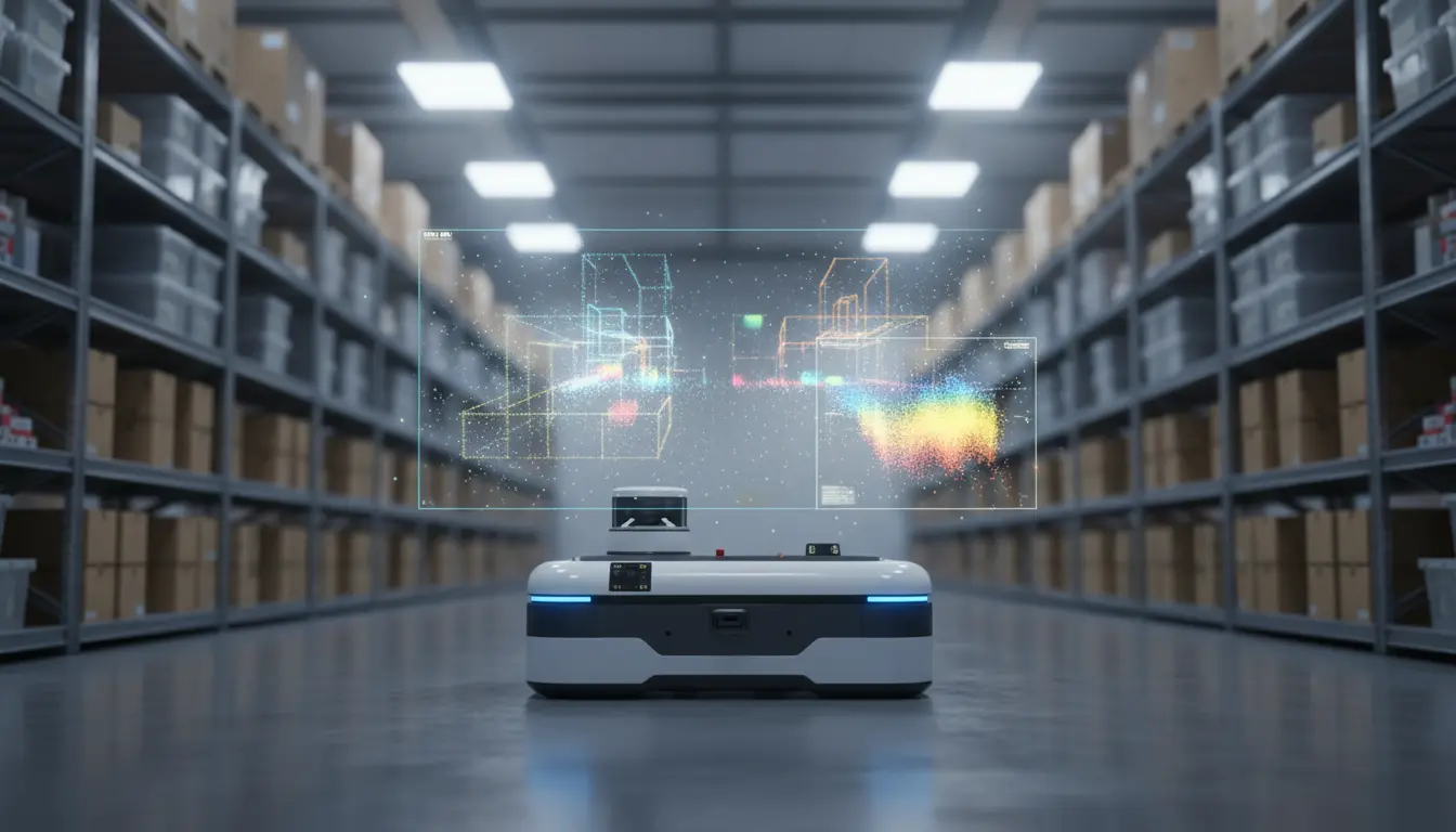
Industrial and service robots also benefit from LiDAR and ToF sensors. Warehouse robots rely on 2D and 3D LiDAR for navigation, obstacle avoidance, and pallet detection. Delivery robots use depth sensing to move in crowded sidewalks and shared spaces. Even consumer‑grade robot vacuum cleaners now ship with compact LiDAR modules to create accurate floor maps and systematically clean rooms instead of moving randomly.
In all these scenarios, depth sensors provide more than just distance. They offer semantic understanding of the environment, which improves safety, efficiency, and user trust.
3D Mapping, Surveying, and Digital Twins
LiDAR has become a standard tool for 3D mapping and geospatial applications. Surveyors mount LiDAR systems on drones, airplanes, or vehicles to capture detailed 3D models of cities, forests, and infrastructure. These point clouds support urban planning, flood risk analysis, and environmental monitoring.
In construction and architecture, LiDAR‑based as‑built documentation speeds up renovation and inspection workflows. Engineers generate precise BIM (Building Information Modeling) datasets and digital twins of existing structures. ToF depth sensors can complement this workflow at smaller scales, for example when scanning individual rooms, equipment, or interior spaces.
Because LiDAR works day and night and can penetrate sparse vegetation, it reveals terrain features that are hard to detect with regular photography. Archaeologists use airborne LiDAR to discover hidden ruins under forest canopies, while utilities rely on it to monitor power lines and vegetation encroachment.
AR, VR, and Spatial Computing
Consumer ToF depth cameras have opened the door for spatial computing and immersive experiences. Smartphones and tablets with depth sensors can instantly understand room geometry, recognize surfaces, and place virtual objects that interact believably with the physical world.
In augmented reality (AR) applications, ToF sensors support:
- Accurate plane detection for placing virtual furniture or products
- Occlusion, where virtual objects correctly appear behind real‑world objects
- Body tracking and gesture recognition for interactive apps and games
Virtual reality (VR) and mixed reality headsets use depth sensing to build a live mesh of the user’s environment. This mesh enables room‑scale tracking, guardian boundaries, and safe interaction with real objects while wearing a headset. Depth data also helps improve hand tracking and object manipulation without controllers.
Retailers and e‑commerce platforms integrate LiDAR/ToF‑based AR tools to let customers virtually try furniture, décor, or appliances at home. This reduces product returns, increases engagement, and makes the shopping experience more informative.
Industrial Automation and Quality Control
In manufacturing, LiDAR and ToF depth sensors support automation, inspection, and safety. Depth cameras mounted along production lines measure dimensions, check tolerances, and detect defects that 2D cameras may miss. For example, a ToF sensor can verify the fill level in transparent containers or confirm that parts are assembled correctly in 3D space.
Collaborative robots (cobots) use depth sensing to work safely beside human operators. ToF cameras detect human presence and adjust robot speed or stop motion entirely when someone enters a safety zone. Logistics operations deploy depth‑enabled vision systems for pallet detection, box measurement, and automated volume calculation for shipping.
Because depth sensors are non‑contact and work at high speed, they improve throughput and reduce the need for manual inspection. This leads to more consistent quality and lower operational costs.
Smart Homes, Security, and People Awareness
ToF depth sensors are increasingly embedded in smart home and building automation products. Presence‑detection sensors use ToF to distinguish between humans, pets, and random motion, which makes lighting and HVAC control more intelligent and energy‑efficient.
In security and access control, depth sensing adds a robust layer on top of traditional cameras. 3D facial recognition systems use ToF data to resist spoofing attacks with photos or videos. Smart locks and entry systems leverage depth information to verify liveness and improve authentication accuracy.
Instead of capturing full‑color images, a ToF sensor provides anonymous silhouettes that still reveal falls, unusual motion patterns, or absence of activity. This protects user privacy while enabling continuous monitoring.
Challenges, Limitations, and Future Trends
Despite their advantages, LiDAR and ToF depth sensors face several challenges. Reflective or transparent surfaces can lead to noisy or missing depth points. Strong sunlight may overwhelm some ToF cameras, and heavy rain, snow, or fog can degrade LiDAR performance. Manufacturers address these problems by improving wavelength choices, optical filters, and sensor fusion algorithms.
Cost and power consumption are also key factors, especially for automotive and mobile applications. The industry is moving toward solid‑state LiDAR and more integrated ToF sensors that reduce moving parts, increase reliability, and lower bill‑of‑materials costs.
Looking ahead, depth sensing will become a standard capability in many connected devices. As AI models get better at interpreting 3D data, we will see smarter robots, richer AR experiences, and more responsive smart environments. The combination of LiDAR, ToF, and machine learning will be central to the next wave of spatially aware products and services.