
Next-Gen Aerial Safety: Why Obstacle Avoidance Drones Are Transforming the Skies
Modern unmanned aerial vehicles represent a massive leap forward in aviation technology, transforming how creators, surveyors, and recreational pilots navigate complex environments. For years, the greatest risk facing any pilot involved unexpected collisions with tree branches, buildings, power lines, and unexpected terrain changes. Today, modern engineering eliminates much of this anxiety by implementing intelligent navigation systems that proactively scan, interpret, and react to surrounding environments.
Understanding how intelligent flight systems function empowers pilots of every skill level to fly further, capture smoother footage, and safeguard their valuable equipment against catastrophic accidents.
The Evolution of Flight Safety in Modern Drones
Early multi-rotor aircraft depended entirely on manual pilot skill and basic GPS stabilization to maintain altitude and heading. If a pilot lost line of sight or misjudged spatial depth through a video monitor, the aircraft frequently crashed into nearby obstructions.
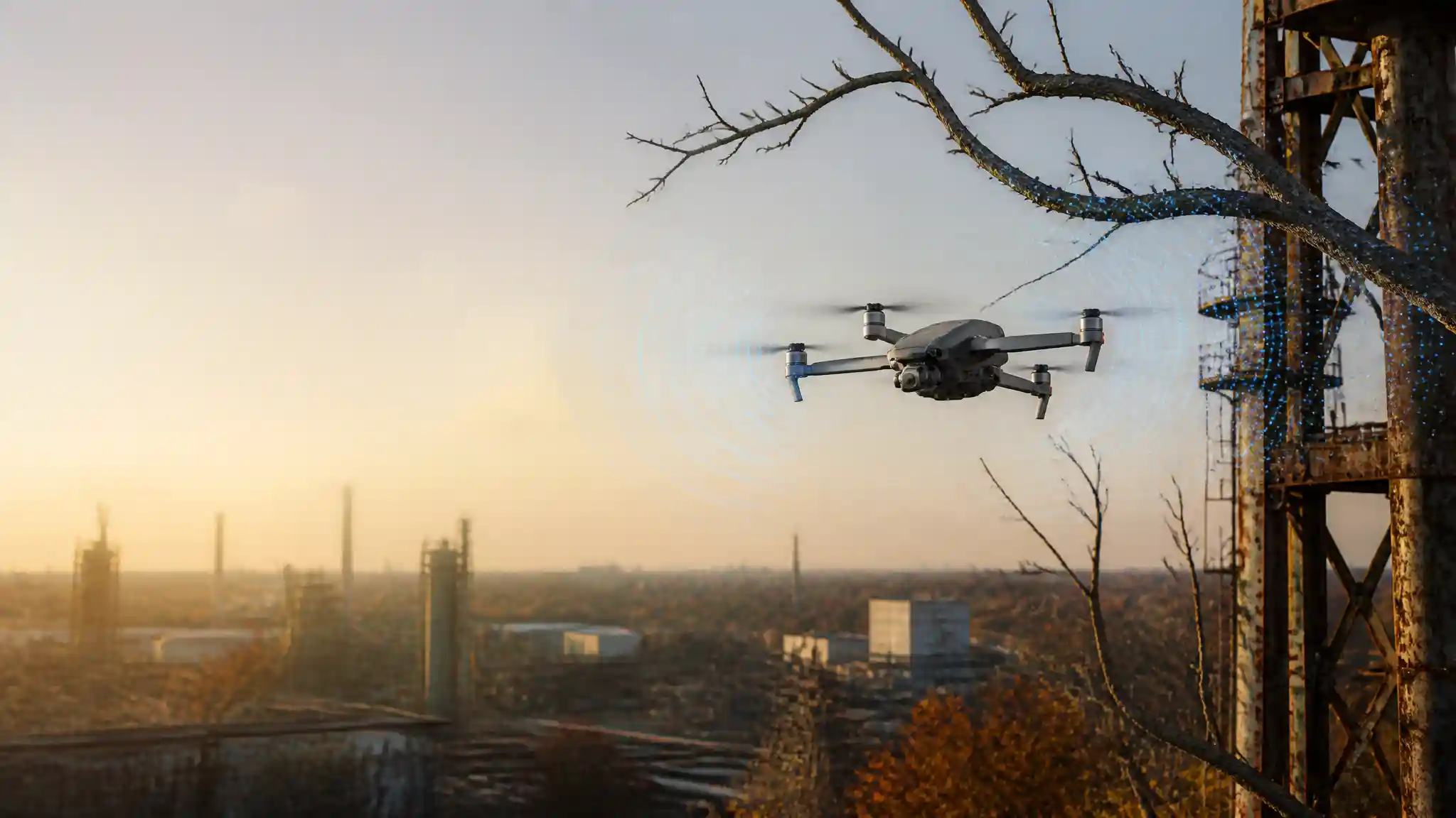
Modern designs overcome these operational limitations by integrating robust obstacle avoidance technology. Instead of relying solely on remote inputs from a human operator, the onboard flight computer actively monitors its airspace. When sensors detect a stationary or moving barrier along the intended trajectory, the system either executes an autonomous flight reroute or brings the aircraft to an immediate, stable hover. This fundamental shift from passive positioning to proactive environmental sensing marks the beginning of truly autonomous, crash-free aerial operations.
Core Sensor Technologies Behind Intelligent Navigation
Crash prevention relies on multiple complementary sensor types working in harmony. Engineers combine different physical scanning methods to ensure reliable operation across various lighting conditions, flight speeds, and environments.
Stereo Vision Systems
Stereo vision cameras mimic human binocular vision by calculating depth through visual disparity. By analyzing slight differences between images captured simultaneously from spaced lenses, the flight computer constructs an accurate 3D spatial map of the immediate surroundings. These visual sensors excel in bright daylight conditions and allow the aircraft to identify complex structures like scaffolding, utility poles, and architectural facades.
Time-of-Flight and LiDAR Sensors
Time-of-Flight (ToF) sensors and mini-LiDAR modules project invisible light pulses into the environment and measure the precise duration it takes for those photons to bounce back. Because these systems generate their own light sources, they perform reliably in dim lighting where standard optical cameras struggle. They provide high-precision distance measurements that help the aircraft navigate tight gaps and maintain exact heights during low-altitude passes.
Ultrasonic and Infrared Transceivers
For close-proximity ground detection, ultrasonic sensors emit high-frequency acoustic waves toward the landing surface. These sound waves measure vertical clearance with millimeter accuracy, ensuring gentle touchdowns and preventing premature descents over water or reflective glass surfaces where optical sensors might misread depth.
Omnidirectional Sensing and 360-Degree Protection
Basic aircraft models often feature front-facing and downward-facing sensors, which adequately protect the drone during straightforward forward flights. However, cinematic maneuvers, complex inspections, and automated tracking routines demand broader spatial awareness.
Full omnidirectional sensing covers forward, backward, upward, downward, and lateral blind spots simultaneously. When tracking a moving athlete through a dense forest or orbiting an architectural structure, the drone frequently flies sideways or backward. Omnidirectional sensor arrays continuously inspect the aircraft’s blind spots, ensuring that dynamic maneuvers do not end in sudden side collisions. This comprehensive 360-degree envelope enables creators to execute sophisticated cinematography without constant fear of hidden tree limbs or building corners.
Machine Learning and Real-Time Path Planning
Hardware sensors only capture raw data; sophisticated software transforms that data into safe flight trajectories. Leading flight platforms run specialized path-planning algorithms, such as DJI’s Advanced Pilot Assistance Systems (APAS), powered by onboard machine learning chips.
Instead of abruptly slamming on the electronic brakes whenever an obstacle enters the frame, intelligent path planning calculates a continuous bypass vector in real time. The drone dynamically recalculates its flight path, banking around trees, rocks, and architectural overhangs without interrupting video recording or losing tracking lock on the primary subject. This capability separates basic collision warning systems from true autonomous flight intelligence, giving commercial operators smooth workflows during automated missions.
Practical Applications Across Key Industries
Intelligent sensing and collision prevention deliver immense value across commercial, industrial, and creative fields.
+---------------------------+-------------------------------------------------------+
| Industry / Application    | Primary Operational Benefit                           |
+---------------------------+-------------------------------------------------------+
| Filmmaking & Content      | Smooth dynamic tracking without manual collision risks|
| Infrastructure Inspection | Safe close-up navigation around bridges & power lines |
| Search and Rescue (SAR)   | Reliable nighttime navigation through disaster zones   |
| Precision Agriculture     | Automated terrain contouring over uneven topography   |
+---------------------------+-------------------------------------------------------+
Commercial pilots conduct close-proximity structural inspections on cell towers and wind turbines with complete confidence, knowing the drone’s proximity alarms will prevent the aircraft from drifting into turbine blades or support cables. In search and rescue operations, first responders deploy automated drones across wooded disaster zones at night, relying on ToF sensors and thermal cameras to clear obstacles while scanning for survivors.
Navigating Sensor Limitations and Best Operational Practices
While modern obstacle avoidance systems offer remarkable protection, pilots must recognize environmental conditions that can temporarily impair sensor accuracy.
Direct glare from low-angle sunlight can blind optical lenses, while transparent glass surfaces and smooth water bodies can distort distance calculations. Similarly, thin wires, transparent monofilament fishing lines, and bare winter twigs can fall below the minimum resolution threshold of certain stereoscopic sensors.
To maximize safety, pilots should always update their drone’s firmware regularly, calibrate visual sensors before mission-critical flights, and maintain manual situational awareness regardless of automated assistance levels.
The Future of Autonomous Flight Safety
Looking ahead, the integration of 4D imaging radar and onboard AI chips will push flight safety even further. As computational efficiency increases, even sub-249-gram ultralight recreational drones will carry comprehensive multi-sensor suites, making aerial collisions a relic of early drone history.
Recommended Product on Amazon.com
For pilots seeking commercial-grade omnidirectional sensing, superior image quality, and advanced subject tracking, the following model represents the gold standard in modern flight safety:
- Product Recommendation: DJI Air 3S (Available on Amazon.com)
- Key Safety Features: Forward-facing LiDAR, omnidirectional active obstacle sensing, Nightscape APAS for low-light collision prevention, and dual primary cameras with Next-Gen Smart RTH (Return to Home).