
Best Drones for Mapping and Land Survey Projects (2025 Guide)
Unmanned Aerial Vehicles (UAVs), commonly called drones, have become essential tools for mapping and land survey projects. Thanks to high‑resolution cameras, advanced GNSS positioning, and powerful flight‑planning software, surveyors can now collect accurate geospatial data faster and more safely than with traditional methods alone. In this guide, you’ll learn what makes a drone suitable for professional surveying, key features to look for, and concrete model recommendations you can use in real‑world mapping workflows.
Why Use Drones for Mapping and Land Surveying?
Drones significantly transform how engineers, surveyors, and construction professionals capture topographic data.
1. Speed and Efficiency
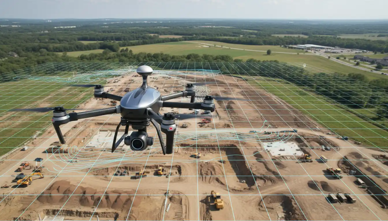
A well‑planned drone mission can map several hectares in minutes. Instead of spending days walking a site with total stations or GNSS rovers, survey teams can fly a single automated mission and process the data into orthomosaics, elevation models, and 3D point clouds. This acceleration reduces project timelines and frees specialists to focus on analysis rather than raw data collection.
2. Cost Reduction
Although professional survey‑grade drones are not cheap, they quickly pay for themselves. Even smaller firms can now compete on large‑scale mapping contracts using drone technology.
3. Safety and Accessibility
Drones allow surveyors to capture data over steep slopes, busy highways, quarries, mines, or unstable ground without entering hazardous zones. This not only improves safety but also lets teams access areas that would otherwise be too dangerous, time‑consuming, or expensive to measure by foot.
Key Features of the Best Drones for Mapping and Land Survey Projects
Selecting the right UAV for mapping and surveying requires more than just choosing a drone with a good camera. Professional users should evaluate several core criteria.
1. Camera Quality and Sensor Options
High‑resolution sensors are crucial for detailed orthophotos and accurate measurements.
- Megapixels and sensor size: A larger sensor with more megapixels captures sharper imagery and improves ground sampling distance (GSD). Professional survey drones often use 20 MP or higher cameras.
- Mechanical shutter: For mapping, mechanical shutters help prevent rolling‑shutter distortion when flying at speed, resulting in more accurate photogrammetry outputs.
- Specialized sensors: Some projects require multispectral, thermal, or LiDAR payloads for environmental monitoring, vegetation analysis, or high‑density 3D models.
2. Flight Time and Coverage
The best drones for land surveying offer long endurance so you can cover wide areas in a single mission.
- Extended battery life: Look for drones with at least 25–35 minutes of real‑world flight time under load.
- Fixed‑wing vs. multirotor: Fixed‑wing drones generally cover larger areas per flight and are ideal for large‑scale corridor mapping or agricultural surveys. Multirotors provide better hovering ability and flexibility on smaller or more complex sites.
3. Positioning Accuracy (GNSS and RTK/PPK)
Accuracy is non‑negotiable in professional surveying.
- GNSS modules: Professional survey drones integrate GPS, GLONASS, Galileo, and other constellations for robust positioning.
- RTK (Real‑Time Kinematic): RTK‑enabled drones receive corrections from a base station or network, improving positional accuracy to the centimeter level in real time.
- PPK (Post‑Processed Kinematic): PPK workflows allow you to refine the drone’s trajectory after the flight, often achieving very high accuracy without the need for continuous live corrections.
These technologies reduce reliance on ground control points (GCPs), saving time while still meeting strict accuracy standards for engineering and construction projects.
4. Mapping and Flight‑Planning Software
Powerful software is just as important as the hardware. The drone you select should integrate smoothly with survey‑grade planning and processing tools.
- Mission planning apps: Look for user‑friendly apps that support grid missions, corridor mapping, terrain following, and automatic overlap control.
- Photogrammetry and GIS tools: Compatibility with industry‑standard tools—such as Pix4D, Agisoft Metashape, DJI Terra, or similar software—ensures seamless processing from images to deliverables like DEMs, DSMs, and contour lines.
- Data export formats: The drone ecosystem should support common geospatial formats such as GeoTIFF, LAS/LAZ, DXF, and shapefiles for easy integration with CAD and GIS platforms.
5. Durability, Reliability, and Support
Commercial survey drones must withstand heavy field use and varying weather conditions.
- Rugged construction: Weather‑resistant airframes, protected gimbals, and high‑quality materials protect your investment.
- Redundancy and safety features: Obstacle avoidance, return‑to‑home, and fail‑safe battery management reduce the risk of crashes and data loss.
- Vendor ecosystem and support: Strong technical support, firmware updates, and access to spare parts minimize downtime.
Popular Use Cases for Survey Drones
Professional mapping and land survey projects benefit from properly selected UAV systems in many industries.
1. Construction and Infrastructure
Survey drones help construction teams track earthwork progress, verify design compliance, measure stockpile volumes, and monitor roads, bridges, and pipelines. Regular aerial surveys support progress reporting and early detection of design deviations.
2. Land Development and Urban Planning
Developers and urban planners rely on up‑to‑date orthomosaics and 3D models for feasibility studies, parcel subdivision planning, zoning, and infrastructure expansion. High‑resolution drone imagery provides a reliable base layer for CAD drawings and planning documents.
3. Mining and Quarry Operations
In open‑pit mines and quarries, UAVs map excavation areas, calculate daily or weekly volumes, and improve operational safety. Drone‑based survey workflows often replace manual stockpile measurements and risky on‑foot inspections.
4. Agriculture and Environmental Monitoring
Survey‑capable drones, especially those with multispectral or thermal sensors, support precision agriculture, watershed management, forestry inventories, and environmental impact assessments. Accurate aerial maps help visualize crop vigor, erosion, and land‑use changes over time.
Recommended Drone Characteristics for Professional Surveyors
To choose the best drone for mapping and land survey projects, create a checklist around your typical jobs:
- Accuracy requirements: Engineering‑grade or planning‑level? This determines whether you need RTK/PPK and how many GCPs are required.
- Site size: Small urban lots favor multirotors; large rural or infrastructure corridors often benefit from fixed‑wing UAVs.
- Terrain complexity: Terrain‑following and high obstacle avoidance are important in hilly or forested areas.
- Regulatory environment: Confirm your local UAV regulations regarding maximum altitude, line‑of‑sight, and pilot certifications.
- Budget and ROI: Factor in training, software subscriptions, batteries, and accessories alongside the drone itself.
Amazon Product Suggestion: Survey‑Grade Drone Kit
For professionals and advanced users seeking a solid platform available on Amazon, consider the DJI Mavic 4 pro series. It is widely used in mapping and survey workflows because it offers:
- A high‑resolution camera with a mechanical shutter
- Excellent flight time and strong wind resistance
- RTK capability (when paired with the RTK module) for centimeter‑level accuracy
- Integration with major photogrammetry and GIS software solutions
When purchasing on Amazon.com, ensure that the package includes the Enterprise model (not just a consumer version), and check whether the RTK module, extra batteries, and a suitable controller are part of the bundle.