
Deep Ocean Sensor Buoys and Climate Data Networks: The Backbone of Ocean Monitoring
Deep ocean sensor buoys are becoming one of the most critical tools for understanding how our planet’s climate is changing. Deployed far from the coast and anchored in deep waters, these autonomous systems continuously collect environmental data and send it to global climate data networks. Thanks to this real‑time information, scientists can track ocean warming, sea level rise, extreme weather patterns and long‑term climate trends with unprecedented accuracy.
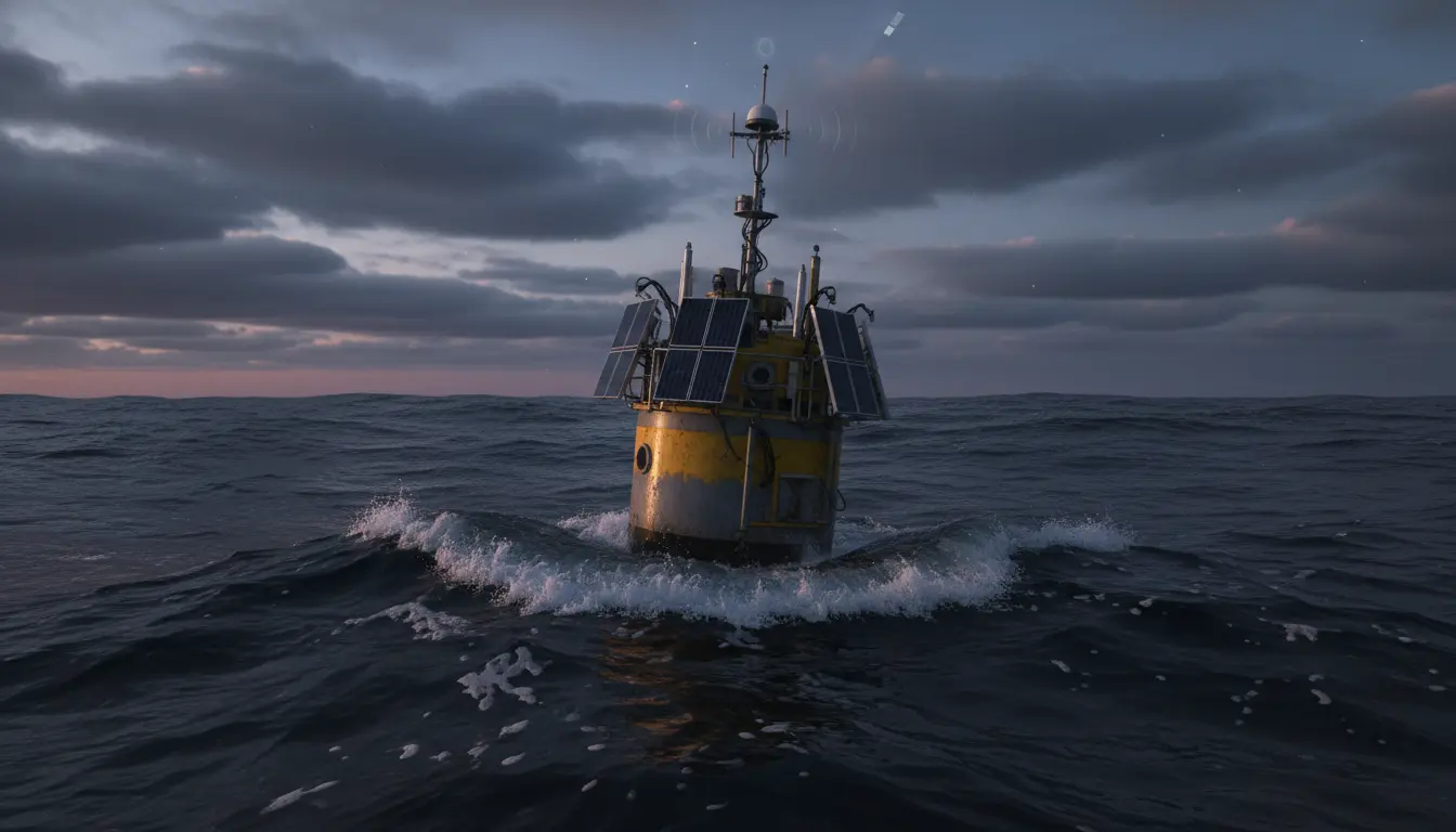
At their core, deep ocean sensor buoys are floating monitoring stations equipped with advanced instruments. They typically measure parameters such as temperature, salinity, dissolved oxygen, pH, nutrient levels, currents and wave characteristics. Many systems also carry meteorological sensors for wind speed, air pressure, humidity and solar radiation. Together, these datasets form a detailed picture of how the ocean and atmosphere interact over time.
What makes deep ocean sensor buoys especially valuable is their ability to operate continuously in harsh marine environments where research ships cannot stay for long periods. Their robust housings, corrosion‑resistant materials and energy‑efficient electronics are designed to withstand strong currents, storms and high pressure conditions. Combined with satellite communications, they can transmit climate data from some of the most remote areas of the global ocean.
How Deep Ocean Buoys Feed Climate Data Networks
The data captured by sensor buoys does not stay on the devices. Instead, it is integrated into large‑scale climate data networks managed by international collaborations, national meteorological agencies and research institutes. Through satellite links and sometimes acoustic modems, information is sent to onshore data centers, where it is validated, standardized and archived in open‑access databases.
These climate data networks combine buoy measurements with data from Argo profiling floats, research vessels, coastal stations and satellites. The integrated datasets are then used to improve numerical weather prediction models, seasonal climate outlooks and long‑term climate projections. In particular, deep ocean sensor buoys fill critical gaps in regions where satellite observations are limited, such as beneath clouds, ice cover or at great depths.
For climate scientists, having continuous time series from fixed positions in the deep ocean is essential. Long records allow researchers to separate natural variability from persistent trends caused by human activities. For example, small but consistent increases in deep water temperature can reveal how much heat the ocean is storing, which directly affects global sea level and the frequency of marine heatwaves.
Key Components and Technologies in Deep Ocean Sensor Buoys
Modern deep ocean sensor buoys integrate multiple technologies to ensure accurate measurements and reliable operation over months or even years. Power is usually supplied by a combination of high‑capacity batteries and solar panels on surface buoys. Energy management systems optimize power usage so sensors and communication modules can run efficiently.
The instrumentation package often includes:
- Conductivity–Temperature–Depth (CTD) sensors to measure salinity and temperature profiles
- Acoustic Doppler Current Profilers (ADCPs) to track water current speed and direction
- Optical and chemical sensors to monitor oxygen, pH, chlorophyll and turbidity
- Meteorological sensors mounted on the mast for atmospheric conditions
Data logging and onboard processing systems compress and store information before transmission. Many modern platforms use edge computing techniques to perform initial quality control or event detection at sea. This reduces bandwidth needs and allows the network to flag unusual conditions quickly, such as rapid temperature changes associated with storms, upwelling events or developing El Niño patterns.
Anchoring and mooring design is another critical aspect. Deep ocean buoys may be tethered to seabed anchors thousands of meters below, with mooring lines that support instruments at different depths. Engineers must account for wave motion, currents and biofouling to prevent data loss or structural damage over time.
Role in Climate Change Research and Early Warning Systems
Deep ocean sensor buoys are central to modern climate change research. Because the ocean absorbs more than 90% of the excess heat trapped by greenhouse gases, tracking ocean heat content is vital. Long‑term buoy observations help quantify how fast the ocean is warming and how heat is distributed among different layers, from the surface to the abyss.
These buoys are also part of global early warning systems for extreme weather and climate‑driven hazards. Real‑time wave and sea level data support better storm surge forecasts, allowing coastal communities to prepare for hurricanes and typhoons more effectively. In regions vulnerable to tsunamis, pressure sensors at the seafloor connected to surface buoys can detect sudden changes in water column height, triggering alerts that can save lives.
Another important contribution is the monitoring of ocean acidification. As the ocean absorbs more carbon dioxide from the atmosphere, its pH decreases, affecting marine ecosystems such as coral reefs and shell‑forming organisms. Chemical sensors on deep ocean buoys provide time‑resolved records of pH and carbonate chemistry, enabling scientists to link global emissions scenarios with local ecological impacts.
Data Quality, Standardization and Open Access
The usefulness of deep ocean buoy networks depends heavily on data quality and standardization. International programs have developed strict calibration protocols, metadata standards and quality control procedures to ensure that different networks can be integrated seamlessly. Routine sensor calibrations, redundancy in critical measurements and automated outlier detection help maintain high‑quality climate records.
Open data policies play a key role as well. Many climate data networks make buoy observations freely available to scientists, policymakers and the public. This open access accelerates research, supports more transparent climate assessments and enables new applications in fisheries management, renewable energy planning and maritime safety.
For example, offshore wind developers use long‑term wind and wave datasets from ocean buoys to design resilient infrastructure and optimize turbine placement. Similarly, shipping companies rely on real‑time ocean and weather observations to plan more fuel‑efficient and safer routes.
Future Directions for Deep Ocean Climate Observation
As climate impacts become more pronounced, the demand for high‑resolution, continuous ocean data will continue to grow. Future deep ocean sensor buoy systems are likely to incorporate more autonomous functions, including self‑calibration, adaptive sampling strategies and integration with underwater drones or gliders. Advances in low‑power electronics, long‑life batteries and satellite constellations will further improve coverage and reliability.
Machine learning is also poised to play a larger role. By analyzing historical buoy datasets, algorithms can identify subtle patterns that precede extreme events, such as marine heatwaves or shifts in major currents. When combined with real‑time data streams, these tools could provide earlier and more accurate climate risk forecasts.
Expanding observation networks into under‑sampled regions, such as the Southern Ocean and high‑latitude deep basins, will be another priority. These areas significantly influence global circulation and carbon uptake but remain poorly monitored due to harsh conditions. Robust, next‑generation deep ocean buoys are one of the few practical ways to gather continuous data from these remote environments.
Ultimately, deep ocean sensor buoys and the climate data networks they support form the backbone of evidence‑based climate policy. By delivering objective, long‑term and geographically diverse observations, they allow societies to track progress on emissions reduction, evaluate adaptation strategies and better understand the evolving state of the planet’s largest and most important climate regulator: the ocean.